Explore PIRONGIA
  • Home
  • Explore the Village
    • Explore the History and Culture
    • Explore Whats On: Calendar/Social media >
      • Eat
      • Stay
      • Play >
        • Artists >
          • Our artwork
        • Pirongia Blues Festival
        • Shop
    • Map
  • Explore the Mountain
    • Useful links
    • Together We Climb
  • Community Association
    • Community Hall
    • Community Projects
    • Constitution and Vision statement
  • The Village Messenger
    • About Explore Pirongia

​MOUNT PIRONGIA (959 METRES) IS AN ANCIENT VOLCANO CENTRAL TO THE 17,000 HECTARE PIRONGIA FOREST PARK THAT, WITH ITS DRAMATIC SKYLINE, IS ONE OF THE MOST DISTINCTIVE FEATURES IN THE WAIKATO DISTRICT.

​
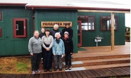
Welcome to Mt Pirongia! (by Clare St Pierre)

I am delighted to lead you on the Mangakara Nature Walk located at the end of Grey Rd, Te Pahu. With me, you will be able to experience firsthand the native biodiversity, wildlife and beautiful natural areas of the mountain.

Enjoy the 1 hour walk with a commentary from Pirongia Te Aroaro o Kahu Restoration Society.. Drive to the start of the walk, and we will follow a well maintained track that is easily accessible to discover one of the most popular spots on Mt Pirongia, with its magnificent mature specimens of native trees, native birds and an attractive mountain stream.

This dormant volcano is home to the 'patupaiarehe' you’ll learn more about them and other aspects of Maori culture from members of Purekireki Marae who also feature on the podcast.  
​
The mountain offers many walking tracks of varying lengths and levels of difficulty.  Pirongia Forest Park is the largest tract of unbroken native bush in the Waikato and stretches to the west coast between Raglan Harbour to the north-west and Kawhia Harbour to the south-west.

From the summit of Pirongia on a clear day a climber is rewarded with breath-taking views of:
  • Mt Karioi to the north-west
  • Mt Kakepuku and Mt Maungatautari to the east
  • Mt Taranaki/Egmont to the south-west
  • Mt Tongariro, Mt Ngauruhoe, and Mt Ruapehu, all shining far away to the south.
Picture
​​


​
  • Difficulty: easy/low fitness requirement
  • Track not suitable for wheelchairs due to steps
  • Footwear: sturdy and low heeled
  • Clothing: warm and waterproof if weather is unsettled
  • Insect repellent in warm weather is suggested
  • Large car park
  • Toilet facilities and sheltered seats at carpark

Home
Contact
Explore Pirongia is a website by the community for the community.  If you've got a suggestion, contribution, or would like to share your 'special place' here, we'd love to hear from you!
  • Home
  • Explore the Village
    • Explore the History and Culture
    • Explore Whats On: Calendar/Social media >
      • Eat
      • Stay
      • Play >
        • Artists >
          • Our artwork
        • Pirongia Blues Festival
        • Shop
    • Map
  • Explore the Mountain
    • Useful links
    • Together We Climb
  • Community Association
    • Community Hall
    • Community Projects
    • Constitution and Vision statement
  • The Village Messenger
    • About Explore Pirongia